

Teaching: In Czech and English
Standard Period of Study: 4 years
Study Form: Full-time study, part-time study
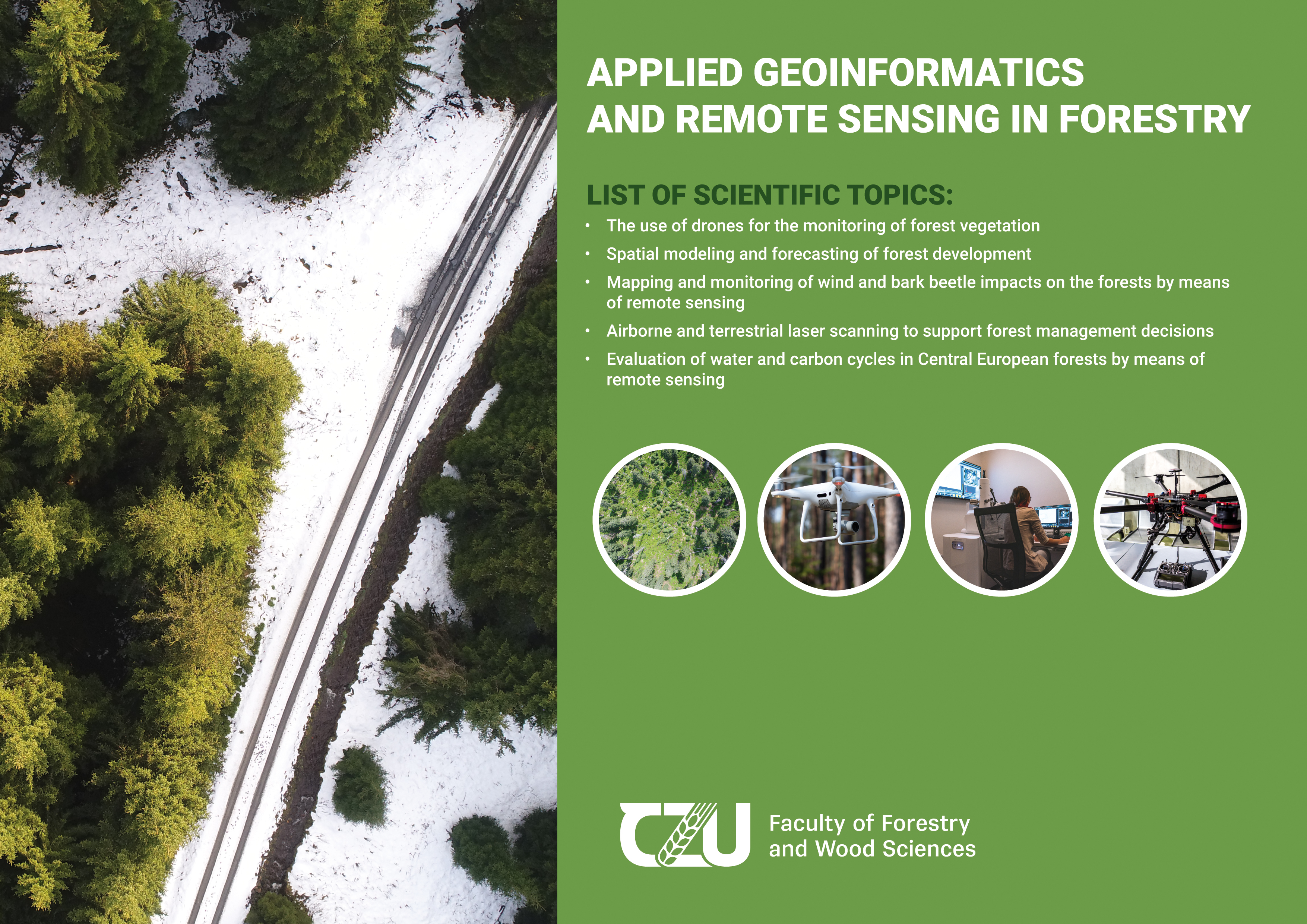
This study program addresses an increasing recognition of the importance of modern technologies for acquisition and analyses of spatial data (including data on forest ecosystems), increasing demands on processing of such data and their use in practical forest management and research. The program strives to prepare experts who are able to use extensive data and knowledge bases to heighten the quality of forestry decision-making and improve, for example, our capacities for crises management related to forest disturbances or forest adaptation to environmental changes. The program emphasises remote sensing-based approaches, including novel tools based on laser scanning and drone operation, spatial optimization of forest landscapes or use of complex ecosystem models. Students are provided with the most-recent technical equipment and diverse software products, and have good opportunities to work in international teams as well as collaborate with forestry practice
| Supervisors: | |
| doc. RNDr. Michal Bíl, Ph.D. | The Transport Research Centre (CDV), Olomouc |
| prof. RNDr. Tomáš Hlásny, PhD. | FFWS CZU Prague |
| prof. Mgr. Jaroslav Hofierka, PhD. | Pavol Jozef Šafárik University in Košice |
| doc. Ing. Jan Kašpar, Ph.D. | FFWS CZU Prague |
| doc. Dr. Ing. Bohdan Konopka | FFWS CZU Prague |
| Ing. Karel Kuželka, Ph.D. | FFWS CZU Prague |
| prof. Ing. Róbert Marušák, PhD. | FFWS CZU Prague |
| Ing. Martin Mikoláš, Ph.D. | FFWS CZU Prague |
| Ing. Martin Mokroš, Ph.D. | FFWS CZU Prague |
| doc. Ing. Peter Surový, PhD. | FFWS CZU Prague |
| doc. Ing. Petra Šímová, Ph.D. | FES CZU Prague |
| doc. Ing. Daniel Zahradník, Ph.D. | FFWS CZU Prague |
DOCTORAL STUDY PROGRAMMES AT FFWS CZU
UNIVERSITY CAMPUS TOUR
The list of examiners for Boards for state doctoral exams at FFWS CZU Prague HERE